

Geodime News
Impacts of new survey technologies on mining and quarrying
29 March 2019
In the March 2019 edition of Quarry Management, we discuss land surveying of the future. Things are likely to look very different, but what will this mean for the surveyor, and the client?
Combining sensors and remote vehicle platforms
14 March 2019

The above 3D model shows the possibilities of combining multiple remote sensing techniques, using multiple sensors and multiple types of unmanned autonomous vehicles, to conduct a survey.
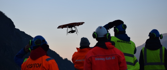
Using drones to identify hazards in mines and quarries
15 September 2017

Induction videos are a growing new service at Geodime, allowing us to use our UAVs capable of stunning 4K footage to identify hazards for induction purposes.
Scanning mines with SLAM technology
25 January 2017

Laser scanning a mine highlights the accuracy, quality, and volume of data possible with this technology.
Using drones to inspect ancient buildings
20 November 2015

At a recent conference Geodime gave a talk discussing the emerging role of UAVs in ancient building inspection and conservation.
Geodime exhibits at SkyTech 2015
01 May 2015

We had a fantastic time at SkyTech 2015 last Friday at the Business Design Centre, Islington.
Meeting the challenges of new technology for surveying
30 April 2015
What do the emergence of drones and “big data” mean for the future of land surveying? Find out in our new Quarry Management article.
UAVs in Agriculture - The Challenges
17 April 2015

Take a look at our UAVs in Agriculture article in April's issue of Farming Monthly
Geodime is on the search for a UAV pilot
29 January 2015

Geodime is expanding and is on the search for a UAV pilot to join our team in Southern England
